


Just for fun! This QGIS Processing algorithm creates dummy surveys with line, tie-lines and noisy data.
Lines and tie lines are not straight lines: noise is added to the X- & Y-coords. Data is a periodic function with lots of noise and spikes.
Distributed under the GPL licence
This algorithm works only on QGIS version 3.x.
This algorithm is part of the Processing geoprocAlgos plugin. Once installed the geoprocAlgos plugin can be found in the 'Processing toolbox'.
Please report any bug/problem/wish on GitHub.
Contents
numpy should be installed with your QGIS installation. If not, it can be "pip install" from the QGIS command line (pip install numpy).
Minimum modules version required to run this algorithm:
See here for installation instruction.
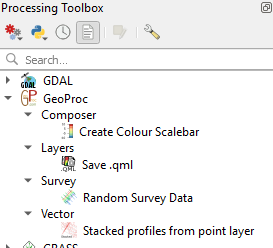
Once successfully installed the algorithm is found in the Processing toolbox under GeoProc -> survey -> Random Survey Data
Double-click "Random Survey Data" to launch the configuration window.
A survey is made of parallel lines and perpendicular tie-lines. Ratio line over tie-line is set at 10. Lines are made of a number of data points. Lines can have any direction.
Noise is introduced in each point coordinates, but consecutive points cannot cross each other, they increase along the line in one direction only. The orientation of every second line is inverted. Data is made of a damped periodic signal on which noise and spikes are added.
The following parameters are used to create your dummy survey:

A new layer is created by default in QGIS Layers pane. This is a point vector layer that can be used as you wish. It has 5 fields: "X", "Y", "FID", "Line" and "Data".

Display of randomly generated survey location.
Click to zoom

Display of randomly generated data for the above survey.
Published date: 01 Jun 2019.